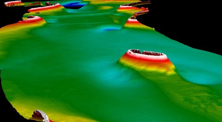
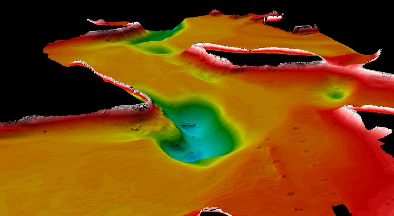

[Images: Geoacoustic topographical maps of the seafloor outside Sydney, Australia, taken by the GeoSwath].
Geoacoustics basically means using sound to map a distant landscape. This includes the seafloor: you bounce soundwaves off the bottom, and the time it takes for the echoes to come back reveals landscape depth and other topographical details – sometimes even shipwrecks and alien cities – what –
(You can read a bit more about geoacoustics through a series of PDFs at the Woods Hole Marine Seismology and Geoacoustics Group homepage).
Bats, for instance, can be said to navigate geoacoustically.
In any case, these images are geoacoustic landscape maps of the ocean floor outside Sydney, Australia –
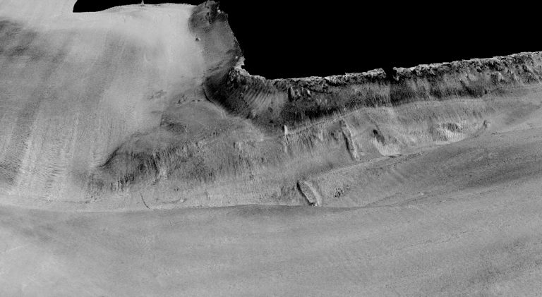

– including an undersea plane wreck, also mapped with geoacoustics. It is unclear whether the plane is also near Sydney, however; either way, there are five or six other wreck maps to look at, and the detail is great. If you look, for instance, at the third image in this post you'll see a shipwreck! It's that little oblong geometric object in the bottom-center of the image – which you also see in the monochromatic version, above.
Anyway, to satisfy your inner Steve Zissou, take a look at the Woods Hole Deep Ocean Exploration Unit; and check out these films of echo-scattering on submerged topography. (For another cool film – a simulation of last year's Asian tsunami – see BLDGBLOG's earth.mov).
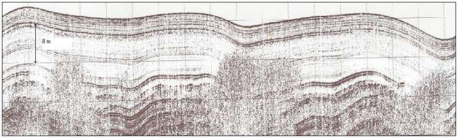
Finally, two more geoacoustic maps:
[Image: A geoacoustic map of the bottom of Lake Vattern, Sweden].
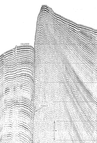
[Image: Geoacoustic map of a faultine off Indonesia].
Perhaps in a few hundred years we'll be producing geoacoustic maps of a submerged New Orleans, or a London done under by tides and estuarial flooding. The undersea canyons of New York, former archipelago.
It'd be interesting, meanwhile, if you could take geoacoustic data and release it as an MP3: you could then listen to the suboceanic landscape's raw sonic topography, compressed aquatic echoes, complete with deepsea ridges and audio-thermal vents. Non-visual mapping of unreachable landscapes. An MP3 of the surface of Mars. The rings of Saturn.
No comments:
Post a Comment