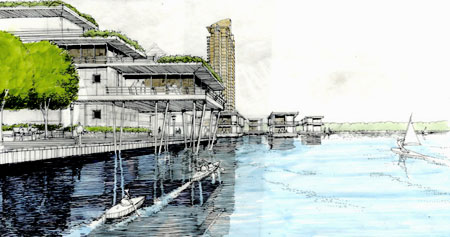
 [Image: Floating homes].
The reliably excellent Brand Avenue reported last month that "business leaders" in Tulsa, Oklahoma, "are proposing a massive change to that city's riverfront: a series of new islands covered with public parks and plazas, residential high-rises, and retail arcades, all made possible by the construction of a massive new dam just upstream."
The project, built upon the alluvial bends of the Arkansas River, will cost nearly $800 million.
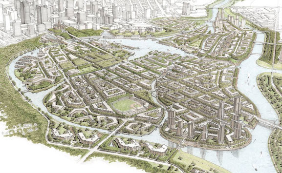
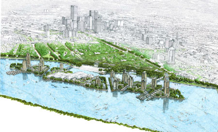 [Image: Aerial view of the Channels].
Referred to as the Tulsa Channels, the scheme is meant "to propel the Tulsa region past its competitors," stunning them all with unapologetic geotechnical ambition. For instance, the whole thing "begins with an impounding dam at the 23rd street bridge." This, in turn, "creates a 12.3-mile lake north to Sand Springs."
At that point:
- A 40-acre, man-made island located between the 11th and 23rd street bridges, itself connected by two bridges to the east bank, rises up from the water and anchors the project. The man-made land mass features low- and high-rise residences to the north and south, separated by navigable canals from the public zone.
It's not just a suburb, it's a machine.
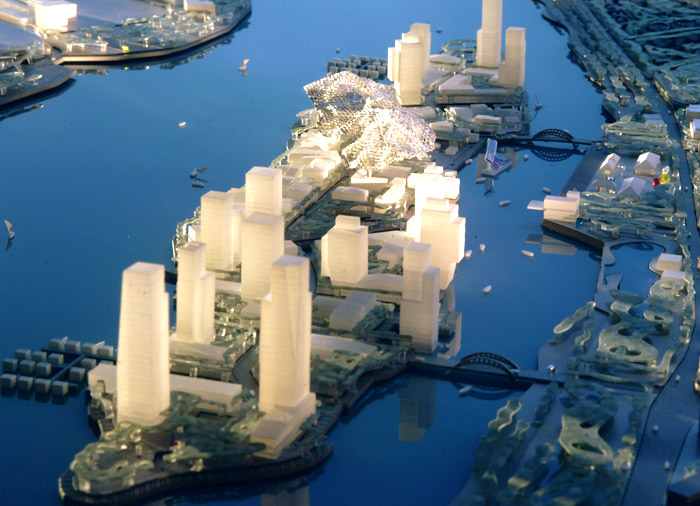
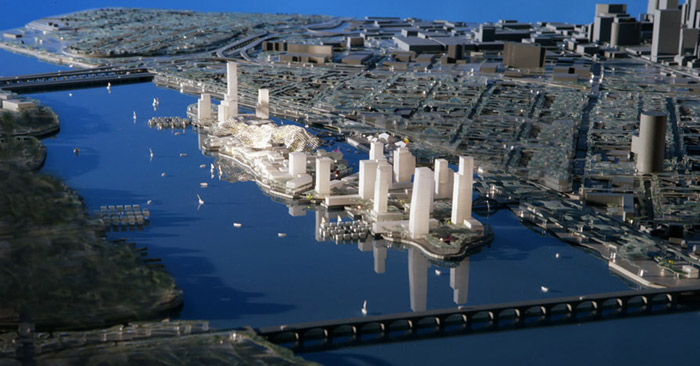 [Image: The Tulsa Channels. Two views of a very Manhattan-like model].
Designed by Vancouver-based architects Bing Thom, the Tulsa Channels takes its place alongside another of that firm's more hydrologically inclined landscape projects: the Trinity River Vision. This is "a master plan for the Trinity River and major tributaries" in Fort Worth, Texas.
 [Image: The Trinity River Vision by Bing Thom. The project "will enable up to 10,000 new homes to be constructed in the area (...) once flood protection is in place and levees are removed to open up the land" – as well as once a "new bypass channel and its related dam and isolation gates" have been constructed].
Brand Avenue – whose original post I've more or less repeated, step by step, in its entirety here (sorry!) – points out that these projects bear much in common with yet another riverine plan: this time for a series of manmade islands off the Mississippi coast of St. Louis, as reported by the Forum for Urban Design.
(Note: While you're reading Brand Avenue, check out their post on the container city).
No comments:
Post a Comment